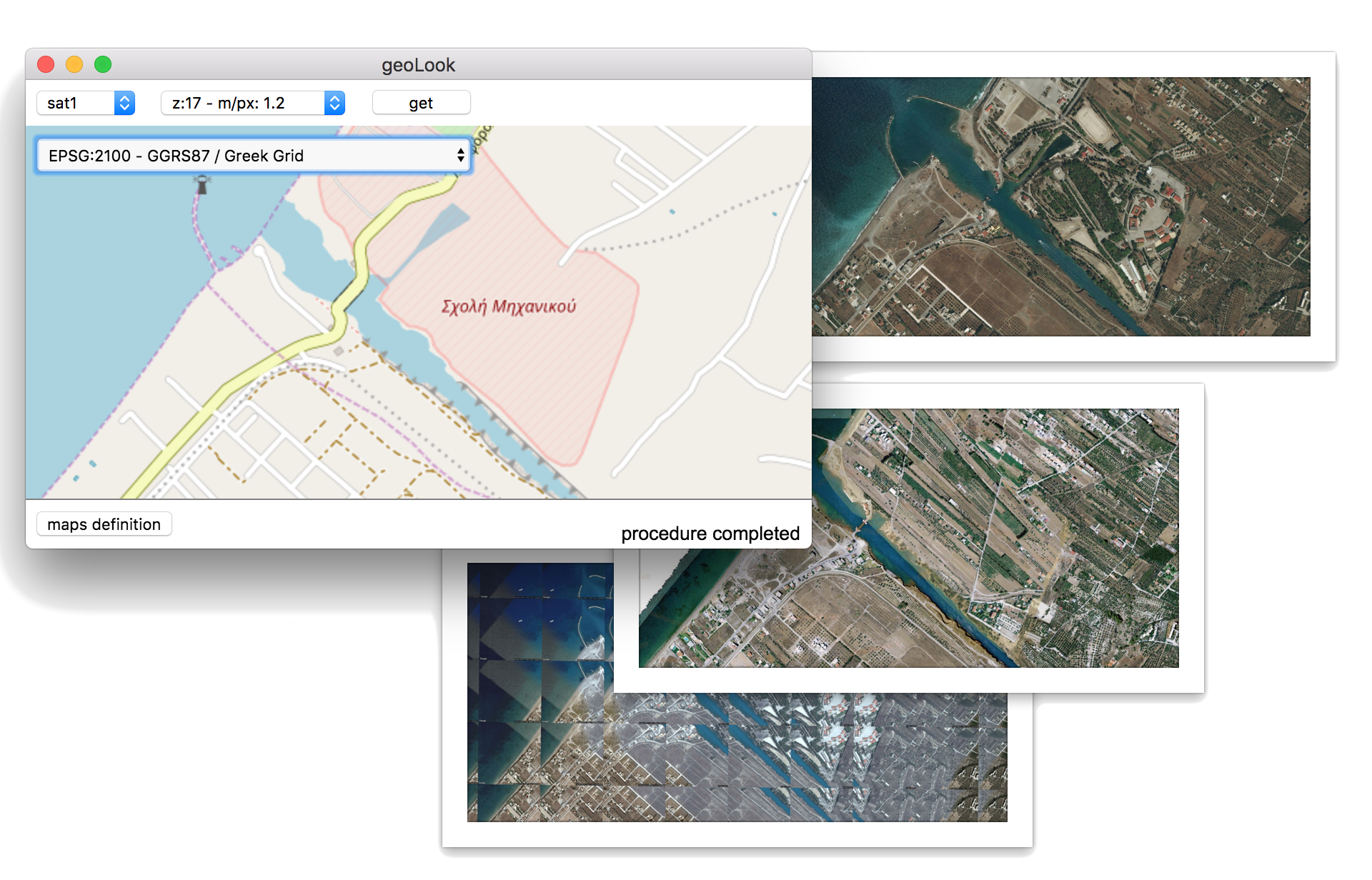
geoLook 3p
Export georeferenced raster images from any available wms base map. Now available on Windows, Linux and OSX. Full cross platform functionality.
Available projections
3910 EPSG defined projections
Basemap Engine
Use integrated basemap definition engine to add any wms layer
Download
windows
mac os
ubuntu (pending)
Basemap definition
The internal basemap definition engine can be used to define any wms service as input layer. The three provided layer definition types (xyz, extent, custom) are described below.
xyz
This mode is the most common method of defining wms url templates. xyz stand for x - y - zoom parameters in the OSM like url definition. The simplest definition is structured as
type:
xyzsize:
256format:
pngurl:
http://{a,b,c}.tile.openstreetmap.org/{z}/{x}/{y}.pngexample files:
OSMextent
This mode is used to define basemaps based on coordinate extent (web mercator system). $x_min, $x_max, $y_min, $y_max, {lat_center}, {lon_center}, {z} represent the image extent, center (lat, lon) and zoom level for each tile.
type:
xyzsize:
256format:
jpgurl:
http://gis.ktimanet.gr/wms/wmsopen/wmsserver.aspx?SERVICE=WMS&VERSION=1.3.0&REQUEST=GetMap&FORMAT=jpeg&TRANSPARENT=true&SRS=EPSG%3A900913&LAYERS=basic&TILED=true&WIDTH=256&HEIGHT=256&CRS=EPSG%3A3857&STYLES=&MAP_RESOLUTION=180&BBOX=$x_min%2C$y_min%2C$x_max%2C$y_max
example files:
google (API key required), ktima (GR)custom
This mode is the most flexible as parameters can be defined as functions (javascript).
